 |
|
|||||||
|
||||||||
| |||||||||||||
|
Help Support |
Orkney Islands
To reach the Orkneys, ferries run from:
As an alternative to the ferry, flights to Kirkwall Airport are available from Aberdeen, Edinburgh, Glasgow, Inverness, Wick and the Sumburgh Airport on Shetland Mainland. During World War Two, after HMS Royal Oak was sunk, Winston Churchill ordered a series of causeways to be built, linking Mainland to South Ronaldsay, Lamb Holm, Glimps and Burray. These are known as the Churchill Barrier and they block off the eastern approach to the naval base at Scapa Flow.
|
Advert |
| ||||||||||||
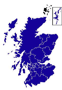 The Orkneys are located about 32 km/20 miles off the north coast of Scotland.
The island group, which is made up of about 70 islands with 17 of these
populated, is separated from the
Scottish mainland by the Pentland Firth. The largest of the islands is known as
The Orkneys are located about 32 km/20 miles off the north coast of Scotland.
The island group, which is made up of about 70 islands with 17 of these
populated, is separated from the
Scottish mainland by the Pentland Firth. The largest of the islands is known as