|


Help Support
the Children's Hospice Association Scotland
| |
Around Stirling
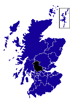 The area of the burgh of Stirling
covers most of the region spreading outwards to include villages such as St.
Ninians, to the south, and Causewayhead, to the northeast. The area of the burgh of Stirling
covers most of the region spreading outwards to include villages such as St.
Ninians, to the south, and Causewayhead, to the northeast.
About 5km/3 miles to the north, following the A9,
is Bridge of Allan, with Dunblane a further 5km/3 miles north - both on the
banks of the Allan Water. Heading south, also on the A9, leads to
Bannockburn.
To the east is Cambuskenneth. The
abbey here was founded
by David I c.1140 for the Augustinians. James III and his wife, Margaret of
Denmark, are buried here, under a tomb that was erected here in 1865. The abbey is now looked after by
Historic
Scotland.
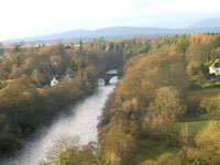 From Stirling, heading roughly northwest along the A84
following closely to the old Military Road, leads
to Callander and the eastern edge of the area referred to as the Trossachs. Just after passing
Deanston, the road crosses the River
Teith and heads towards Doune. The A811, heading west from Stirling, is another route into the
Trossachs,
leading to Balloch at the southern end of Loch Lomond. The
A905 heads south east into the Falkirk area. From Stirling, heading roughly northwest along the A84
following closely to the old Military Road, leads
to Callander and the eastern edge of the area referred to as the Trossachs. Just after passing
Deanston, the road crosses the River
Teith and heads towards Doune. The A811, heading west from Stirling, is another route into the
Trossachs,
leading to Balloch at the southern end of Loch Lomond. The
A905 heads south east into the Falkirk area.
| |

See our bookshop in
association with
amazon.co.uk!

Advert
|